15 Years of Operation · Millions of Acres Flown
Full Season Imagery Built for Prescriptions
While most people think about fields in two-and-a-half-acre grids, we look at them in terms of six-inch pixels. Our imagery is an incredible scouting tool with the ability to build ultra-high resolution prescriptions.
Why AirScout?
We are the only aerial imagery company that captures your entire field in one snapshot. This makes every pixel relative to each other, and is the foundation to building good prescriptions. Others fly a grid pattern and stitch their imagery — this inherently creates problems making their imagery unsuitable for precision work.
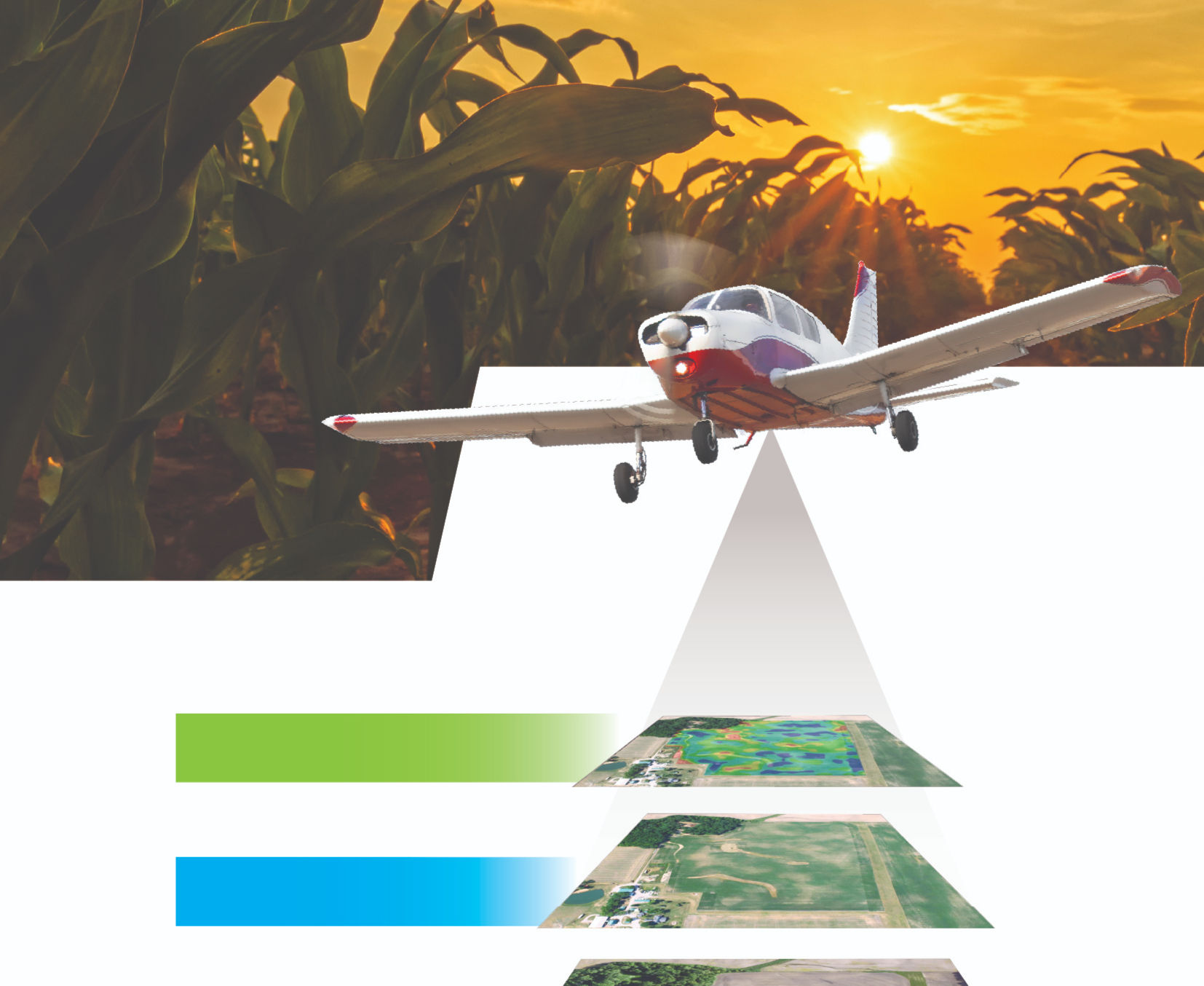
Four Image Types, Complete Field Understanding
Every flyover captures your field across multiple spectra, updated approximately every ten days throughout the growing season.
The most important image you can get — takes you 75% of the way. High-resolution digital imagery snapped to mapping coordinates.
Proprietary to AirScout. Amplifies shades of brown and green, and enables numerical values for building prescriptions.
It's all about water. Provides insight into soil moisture and plant evapotranspiration. Sensitive to 3/100°C.
Strictly shows chlorophyll content. A standard index that complements our other imagery for complete field understanding.
What You Can Do With AirScout
From planting to harvest, thermal and ADVI imagery power decisions across the entire season.
Seed savings alone can pay for an entire year's subscription. Build precision planting prescriptions from thermal zones.
Combine bare soil and in-season imagery to build nitrogen prescriptions tailored to your present crop.
Emergence, insects, and diseases follow soil temperatures. Know where to find the most troubling spots and how much is affected.
Thermal imagery reveals drought and stress zones, so you can build defensive zones and match hybrids to conditions.
Thermal imagery is the first to show drought stress, making it a great tool to build zones for variable rate irrigation.
Our patented Yield Estimator assigns yield potential based on thermal values in combination with directed ground scouting.
HindsightN
Nitrogen Management on a Higher Level
Empower the potential of your fields with smart and actionable information. By analyzing data collected from your field, we build precise prescriptions in real-time for late season nitrogen applications — strategically targeting higher-yielding potential zones with higher N rates.
Step 1
Yield Potential Map
Weekly aerial images captured until approximately V8 provide the foundation — your yield potential map. Soil zones stay constant, but yield zones vary year to year.
Step 2
Mineralization Credit
Bare soil imagery maps high and low organic matter zones, building a mineralization credit map to offset your need for late-season N.
Step 3
Nitrogen Prescription
A custom action plan for the nitrogen still needed — delivered as a shape file prescription to your email or directly to the sprayer.
Gain the Insight to Make Better Farming Decisions
AirScout is a subscription service — sign up in the spring and we capture images as soon as planting begins in your area, continuing approximately every ten days throughout the growing season.
Questions? Call 219-808-7594 or email info@airscout.com